The Coastal Cays of Los Haitises National Park: How Small Islands Shape the Park’s Natural Landscape
One of the most distinctive sights in Los Haitises National Park is the collection of small rocky islands rising from the coastal waters. These natural formations, commonly called cays, create an unusual landscape where limestone rock, tropical vegetation, mangrove forests and sheltered waterways meet.
Unlike the sandy islands often associated with Caribbean beach holidays, many of the cays in Los Haitises have rugged rocky surfaces and steep sides. Some are covered with vegetation, while others appear as exposed limestone formations surrounded by water.
Their appearance is closely connected to the geological history of the region. The same limestone landscape that creates the park's famous hills and caves also helps explain the formation of its coastal islands.
For visitors, these cays add to the beauty of boat excursions through the park. For nature enthusiasts, they are also part of a wider ecological system that supports coastal vegetation, birds and other wildlife.
This guide explores how the coastal cays formed, what makes them different from ordinary beach islands, how they connect with the mangroves and what visitors should know when exploring this remarkable part of Los Haitises.
1. What Are the Coastal Cays of Los Haitises?
A cay is a small, low island. In Los Haitises, the word is commonly used for the small rocky islands and limestone formations found around the coastal waters and bays.
These formations are part of the park's distinctive karst landscape.
The Dominican Republic's official tourism information describes Los Haitises as a protected area with a remarkable series of rock formations rising from the water. It also highlights the cays, mangroves and bird colonies that make the park's coastal environment special.
The cays vary in appearance. Some have steep limestone faces, while others support vegetation that creates a green covering above the water.
They are not all identical in shape, height or ecological character. Their differences reflect the underlying geology, exposure to water and the vegetation that has developed over time.
2. Where Are the Cays Located?
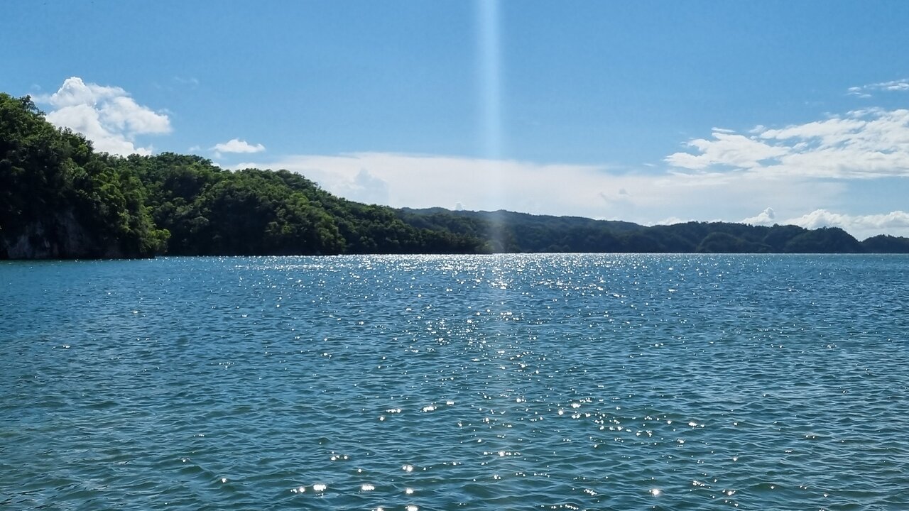
The coastal cays are found in the marine and coastal landscape of Los Haitises National Park, particularly around the sheltered waters of San Lorenzo Bay.
San Lorenzo Bay forms part of the southern coast of Samaná Bay. Its scenery includes limestone formations rising from the water and mangrove vegetation along sections of the coastline.
The area is one of the park's recognizable natural landscapes.
A boat journey through this part of Los Haitises can reveal:
- Small rocky islands.
- Vegetated limestone formations.
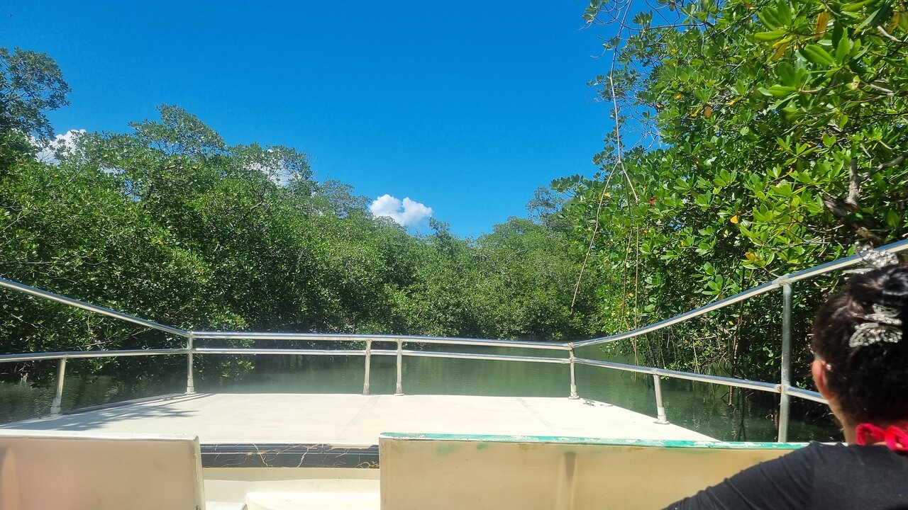
- Mangrove-lined channels.
- Sheltered coastal waters.
- Forest-covered hills in the background.
- Birds using the coastal habitats.
The cays are best understood as part of a connected landscape rather than as isolated sightseeing attractions.
3. How Did the Coastal Cays Form?
The geology of Los Haitises is dominated by limestone and karst formations.
Limestone is a sedimentary rock that can gradually dissolve when exposed to slightly acidic water. Over long periods, rainfall and groundwater can shape limestone into hills, caves, depressions and other distinctive landforms.
The coastal cays are related to this broader geological history.
Ancient limestone landscape
The region developed from limestone rock formed during ancient geological periods.
Over time, water dissolved and reshaped parts of the limestone, creating an uneven landscape.
Erosion and changes in sea level
Coastal erosion and changing sea levels helped shape the relationship between the land and the sea.
Some areas that were once connected to larger limestone formations became separated by water.
Isolated rocky formations
As water occupied lower areas between limestone formations, some higher sections remained above the surface.
These isolated formations became part of the coastal landscape that visitors can see today.
A scientific publication from the Dominican National Botanical Garden describes the relationship between the inland mogotes and the cays of Samaná Bay. It explains that the two share a geological origin, with water occupying the lower spaces between the coastal formations.
This connection helps explain why the landscape of Los Haitises can look like a flooded version of its inland limestone hills.
4. What Makes Los Haitises Cays Different From Sandy Caribbean Islands?
Many Caribbean islands are known for long beaches, white sand and gently sloping shorelines.
The coastal cays of Los Haitises often look very different.
Their appearance is strongly influenced by limestone geology rather than broad sandy beaches.
FeatureCoastal cays of Los HaitisesTypical sandy islandMain visual characterRocky limestone formationsSandy beachesShapeOften irregular or steep-sidedOften gently slopingVegetationMay include coastal and mangrove-associated vegetationDepends on soil and exposureGeological characterKarst-related limestoneOften sand and coral-derived materialMain visitor experienceScenic boat observation and nature explorationBeach activities and swimming
This difference is part of what makes Los Haitises unusual.
Visitors should not assume that every cay is a beach destination or a suitable place to swim. Many are primarily natural landscape and wildlife features.
5. The Relationship Between Cays and Mangrove Forests
The coastal cays do not exist separately from the mangrove ecosystems surrounding them.
Mangroves grow in suitable coastal environments where saltwater and freshwater conditions, tidal influence and sediment create appropriate habitats.
In Los Haitises, mangroves occupy parts of the sheltered coastline and waterways around the bays.
Shelter from coastal conditions
The shape of the coastline and the presence of rocky formations can influence local water movement.
Sheltered areas may provide suitable conditions for mangrove development where other environmental requirements are also present.
Habitat for coastal wildlife
Mangrove roots and surrounding waters provide important habitat for fish, crustaceans and other aquatic organisms.
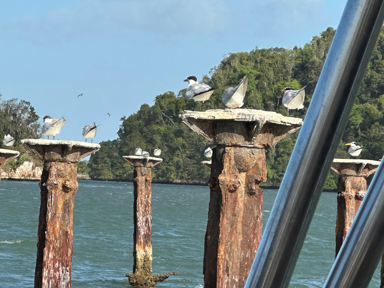
Birds may use the mangroves and nearby cays for feeding, resting or nesting, depending on the species and conditions.
A connected ecosystem
The cays, mangroves and coastal waters form a connected environmental system.
A bird may use a cay for resting, feed in nearby waters and move through mangrove habitats.
This is why protecting the wider coastal landscape matters more than focusing on individual islands alone.
6. Wildlife Around the Coastal Cays
The cays and surrounding waters form part of the wider wildlife habitat of Los Haitises.
Different species use the coastal environment in different ways.
Coastal birds
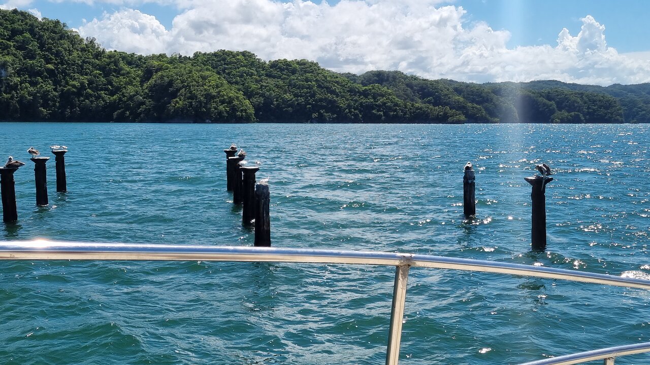
Frigatebirds and pelicans are among the birds associated with the park's cays.
They may be seen flying above the water or resting in suitable locations.
Herons and egrets may also use nearby shallow-water habitats.
Fish and aquatic life
The surrounding coastal waters support aquatic organisms that form part of the local food web.
Mangrove environments nearby can provide important shelter and nursery habitat for some fish and invertebrates.
Reptiles and other wildlife
The wider coastal and terrestrial environments of Los Haitises support a variety of reptiles and other animals.
The presence of particular species on an individual cay should not be assumed. Wildlife distribution depends on habitat, disturbance and natural conditions.
For visitors, the best approach is to observe animals from an appropriate distance and avoid disturbing their behavior.
7. Why San Lorenzo Bay Is Important to the Cay Landscape
San Lorenzo Bay is one of the most recognizable coastal settings within Los Haitises National Park.
Its scenery combines limestone formations emerging from the water with mangrove-covered sections of coastline.
The bay provides an excellent example of how the park's geology and coastal ecosystems come together.
Limestone formations along the water
The limestone formations give the bay a distinctive appearance.
Their steep sides and irregular shapes create a dramatic contrast with the relatively calm water in sheltered areas.
Mangroves along the coast
Mangrove forests occur along sections of the bay and nearby channels.
They contribute to the area's ecological importance and provide habitat for wildlife.
Natural and cultural attractions
The San Lorenzo Bay area is also associated with caves and archaeological features within the park.
Some boat itineraries combine coastal scenery with selected cave visits, subject to current access arrangements.
The bay is therefore more than a scenic location. It is an important part of the natural and cultural landscape of Los Haitises.
8. Cayo de los Pájaros and the Wider Coastal Cays
One of the best-known cays in Los Haitises is Cayo de los Pájaros, also called Isla de los Pájaros.
Its name means Bird Cay or Bird Island.
The island is particularly associated with the observation of frigatebirds and pelicans during boat excursions.
It is an example of how a small coastal formation can become a recognizable feature of a much larger protected landscape.
However, Cayo de los Pájaros is only one part of the park's wider coastal scenery.
Other rocky formations and small islands contribute to the visual character of the bays and waterways.
Visitors interested in the broader geology should look beyond individual named attractions and notice how the limestone formations appear across the landscape.
9. How to See the Coastal Cays During a Park Visit
A guided boat excursion is one of the practical ways to appreciate the coastal formations of Los Haitises.
The boat allows visitors to observe the cays from the water and see how they relate to the mangroves and surrounding landscape.
During an excursion, you may have opportunities to:
- View limestone formations rising above the water.
- Observe vegetation growing on rocky islands.
- See mangrove forests along sheltered coastlines.
- Photograph the contrast between rock, forest and water.
- Watch coastal birds from the boat.
- Learn about the geology from a knowledgeable guide.
The route depends on the operator and current park access arrangements.
Before booking, ask whether the itinerary includes San Lorenzo Bay or other coastal sections where the cays can be observed.
Do not assume that every boat tour visits every island or permits passengers to land.
10. Best Photography Tips for the Coastal Cays
The cays provide excellent opportunities for landscape photography.
Their rocky shapes, green vegetation and surrounding water create strong natural contrasts.
Photograph the formations from the water
A boat offers changing viewpoints as it moves around the coastal landscape.
Use these opportunities to photograph the shape of the islands against the water and forest.
Include surrounding scenery
A photograph that includes the cay, nearby mangroves and distant limestone hills can communicate the scale of the wider landscape.
Look for changing light
Cloud cover and sunlight can change how the limestone and vegetation appear.
Morning and afternoon light may produce different photographic results, but the best conditions depend on the weather and the actual excursion schedule.
Protect your camera
Boat travel can expose equipment to spray and rain.
Use a waterproof bag or protective cover and avoid changing lenses where water could reach your camera.
Avoid disturbing wildlife
Do not ask the boat operator to approach nesting birds simply to obtain a closer photograph.
Use a zoom lens or binoculars when possible.
11. Are the Cays Suitable for Swimming or Landing?
The coastal cays should not automatically be treated as public beaches.
Some formations are rocky, steep or covered with vegetation. Others may have sensitive wildlife habitats.
Whether a particular landing or water activity is permitted depends on park rules, access authorization, the route and conditions.
Before planning an activity, ask the operator:
- Is landing permitted at the specific cay?
- Is the location included in the approved itinerary?
- Is swimming allowed in the proposed area?
- Are there wildlife restrictions?
- Will the group remain on the boat?
A boat-based sightseeing experience may be the most appropriate way to appreciate many of the formations.
Always follow the guide's instructions and the rules established by the park authorities.
12. Conservation Challenges Facing Coastal Cays
Small islands and coastal formations may appear isolated, but they are part of a much larger ecosystem.
Human activity can affect the wildlife and habitats around them.
Potential pressures include:
Litter and plastic pollution
Plastic waste can enter coastal waters and harm aquatic animals.
Visitors should take all rubbish away and avoid leaving food packaging or other waste behind.
Wildlife disturbance
Approaching nesting or resting birds too closely can disturb their behavior.
Boats should follow appropriate routes and maintain respectful distances.
Damage to vegetation
Removing plants or walking through sensitive vegetation can damage habitats.
Visitors should not collect natural objects or disturb the vegetation growing on the cays.
Unsustainable fishing practices
Fishing gear can create risks for marine animals when it is lost, discarded or used irresponsibly.
Protecting coastal habitats requires responsible fishing practices and effective environmental management.
13. Responsible Ways to Explore the Cays
Visitors can help protect Los Haitises by following a few simple practices.
- Choose a responsible operator familiar with the park.
- Follow authorized boat routes.
- Do not land on restricted formations.
- Avoid feeding birds or other wildlife.
- Keep noise low around wildlife habitats.
- Do not throw rubbish into the water.
- Do not remove rocks, shells or plants.
- Follow all instructions from guides and park personnel.
These actions help reduce disturbance and protect the natural features that make the park special.
14. What Should You Bring for a Coastal Boat Excursion?
A boat excursion through Los Haitises may involve several hours outdoors.
Consider bringing:
Sun protection: Sunscreen, sunglasses and a hat.
Drinking water: Carry water according to the operator's instructions.
Camera or binoculars: Useful for observing distant formations and birds.
Waterproof protection: Protect your phone, camera and personal belongings from spray.
Comfortable clothing: Lightweight clothing is practical in warm, humid conditions.
Suitable footwear: Follow the operator's advice, particularly if the itinerary includes walking.
Personal medication: Bring anything you may need during the trip.
Avoid carrying unnecessary valuables.
15. Why the Coastal Cays Matter to the Identity of Los Haitises
The cays are an important part of what makes Los Haitises visually distinctive.
They show the relationship between the park's limestone geology and its coastal environment.
The formations also help visitors understand that the park is not simply a forest or a mangrove reserve. It is a combination of interconnected natural systems.
Its landscape includes:
- Inland limestone hills.
- Coastal rocky formations.
- Small islands and cays.
- Mangrove forests.
- Sheltered bays and waterways.
- Caves and underground geological features.
- Tropical forest habitats.
Together, these features create one of the Dominican Republic's most recognizable natural landscapes.
For visitors, observing the cays from the water can be an especially memorable part of discovering the park.
Frequently Asked Questions
What are the cays in Los Haitises National Park?
They are small islands and rocky formations found in the park's coastal waters. Many are associated with the region's limestone karst geology.
Why are there so many small rocky islands in Los Haitises?
The coastal islands are related to the area's limestone landscape. Geological processes, including dissolution, erosion and changes in sea level, helped create the formations visible today.
Where can visitors see the coastal cays?
They can be observed during suitable boat excursions through the coastal areas of Los Haitises, particularly around San Lorenzo Bay. Confirm the route with your operator.
Are the cays made of limestone?
The coastal landscape is strongly associated with limestone formations. Scientific descriptions of Los Haitises explain the shared geological origin of the inland mogotes and coastal cays.
Is Cayo de los Pájaros one of the coastal cays?
Yes. Cayo de los Pájaros, also called Isla de los Pájaros, is a well-known cay in Los Haitises associated with coastal birdlife.
Do the cays have mangrove forests?
Some coastal areas around the cays are associated with mangrove vegetation. The vegetation varies between locations and should not be assumed to be identical on every island.
Can visitors land on the cays?
Not automatically. Landing depends on the location, park rules and authorized access arrangements. Confirm with your guide before planning a landing.
Can you swim around the coastal cays?
Swimming should not be assumed to be permitted at every location. Ask the operator about the specific route and follow current park restrictions.
What wildlife lives around the cays?
Coastal birds such as frigatebirds and pelicans are associated with the park's cays. Nearby mangroves and waters support other forms of coastal and aquatic life.
What is the best way to photograph the cays?
A boat excursion provides changing viewpoints of the limestone formations, vegetation and surrounding water. Bring camera protection and use binoculars or a zoom lens for distant wildlife.
Final Thoughts
The coastal cays of Los Haitises National Park are much more than small islands scattered across the water. They are part of a remarkable geological landscape shaped by limestone, erosion and the changing relationship between land and sea.
Their connection with mangroves, coastal waters and wildlife makes them an important part of the park's natural environment.
For visitors, these formations create some of the most memorable scenery during a boat excursion. For conservation, they remind us that even small rocky islands can contribute to a much larger ecological system.
When exploring Los Haitises, take time to appreciate the shapes of the cays, the vegetation growing on them and the wildlife using the surrounding habitats.
A responsible visit helps preserve the landscape so that future travelers can continue to experience its natural beauty.
Local explorer & expert guide in Birdwatching Guide.