The Limestone Karst Landscape of Los Haitises: How Its Mogotes and Caves Formed
Los Haitises National Park is famous for its green mangrove channels, forest-covered hills, coastal islands and impressive caves. But beneath this tropical scenery is a geological story that began millions of years ago. The park's unusual landscape was shaped by ancient marine environments, limestone deposits, rainfall, chemical weathering and gradual changes in the Earth's surface.
One of the most recognizable features of Los Haitises is its collection of rounded limestone hills known as mogotes. These formations rise above the surrounding terrain and create the rugged scenery that makes the national park so distinctive. Between them are depressions, valleys, caves and underground drainage features formed through a process called karstification.
Understanding this geology adds another dimension to a visit. Instead of seeing only beautiful hills and caves, visitors can recognize how natural processes created the landscape around Sabana de la Mar and Samaná Bay.
1. What Is the Karst Landscape of Los Haitises?
A karst landscape develops when water gradually dissolves soluble rocks, especially limestone. Rainwater absorbs carbon dioxide from the atmosphere and soil, becoming slightly acidic. As it moves over and through limestone, it slowly dissolves parts of the rock.
Over long periods, this process can create caves, underground passages, sinkholes, depressions, irregular valleys and distinctive hills.
Los Haitises is one of the Dominican Republic's best-known examples of tropical limestone karst terrain. Geological studies describe the area as having an advanced karst development, with both surface features and underground cavities.
The landscape is not the result of one sudden event. It developed through repeated periods of weathering, erosion, geological change and water movement.
2. How Did the Limestone of Los Haitises Form?
The story begins with an ancient marine environment.
Geological research on eastern Hispaniola identifies the Los Haitises Formation as being made mainly of limestone, with layers of marly limestone and marl. These materials developed in a shallow-water marine setting during the Pliocene to Early Pleistocene geological periods.
In ancient coastal waters, marine organisms such as corals, molluscs, echinoids and other carbonate-producing life forms contributed material to the seabed. Their remains, together with carbonate mud and other sediments, accumulated over time.
As these deposits built up and became buried, they gradually hardened into sedimentary rock.
Later geological changes helped bring these marine deposits above sea level. Once exposed to rainfall and surface water, the limestone became vulnerable to dissolution and erosion. This created the conditions for the karst landscape visible today.
The hills and caves of Los Haitises therefore reflect two connected stories: the formation of ancient marine limestone and the much later shaping of that rock by water.
3. What Are Mogotes?
Mogotes are distinctive rounded or steep-sided hills associated with tropical karst landscapes. In Los Haitises, they are among the most recognizable geological features.
Many are covered in dense vegetation, making them appear as green hills rising from a forested landscape or from the waters around Samaná Bay.
Geological descriptions of the Los Haitises region identify mogotes commonly around 30–40 metres high in parts of the karst terrain. Their size and shape vary across the wider area.
Mogotes are not ordinary volcanic mountains. They are formed from limestone that has been shaped by dissolution, weathering and erosion.
Over geological time, water removes material from the limestone and enlarges natural weaknesses in the rock. Some areas become lower or more deeply eroded, while more resistant sections remain as elevated hills.
The result is a landscape of separated limestone hills, depressions and irregular passages.
4. How Rainwater Creates Caves and Underground Passages
Rainfall is one of the most important forces shaping limestone terrain.
When rainwater passes through soil, it absorbs carbon dioxide produced by natural biological activity. This makes the water weakly acidic. As it enters cracks, joints and bedding planes in limestone, it gradually dissolves the rock.
At first, these openings may be extremely small. Continued water movement can enlarge them into fissures, channels and eventually cave passages.
In a mature karst system, water may travel underground instead of flowing entirely across the surface. This creates a drainage system that can include underground streams, cavities and springs.
Los Haitises contains a variety of cave systems and karst cavities. Their existence is part of the same geological process that shaped the surrounding mogotes.
The caves are not simply holes in the hills. They are part of a larger landscape in which surface water and underground drainage are closely connected.
5. Sinkholes, Depressions and Valleys Between the Hills
Another important feature of karst terrain is the presence of depressions.
As limestone dissolves, the ground surface can develop rounded or elongated low areas. Some form through gradual surface dissolution, while others may be connected to underground cavities and changes in the support beneath the ground.
Geologists use several terms for different types of karst depressions, including dolines, uvalas and poljes. These terms describe features of different shapes and scales.
In the wider Los Haitises region, geological mapping identifies dolines, corridors, valleys and other karst landforms.
These depressions help explain why the landscape is so irregular. Instead of a continuous mountain ridge, visitors encounter a complex arrangement of hills and lower areas.
Vegetation can cover many of these features, so their geological structure may not always be obvious from ground level.
6. Why Are Some Mogotes Surrounded by Water?
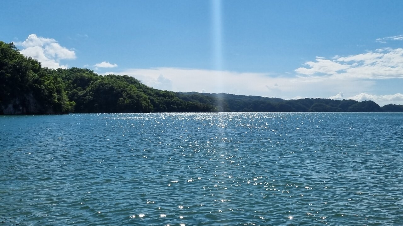
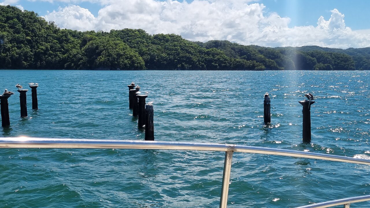
The coastal part of Los Haitises has a particularly dramatic appearance. Limestone formations rise from the water, creating small islands, rocky outcrops and narrow channels.
This scenery is connected to the region's geological history and its position beside Samaná Bay.
As sea levels and coastal conditions changed over geological time, parts of the limestone terrain became surrounded by or partly covered by seawater. Erosion along the coast also helped shape exposed rock surfaces.
Today, visitors travelling by boat can see forest-covered limestone formations rising above the water. These are among the park's most memorable natural views.
Not every mogote is an island, and not every rocky island has exactly the same geological history. Together, however, they show how limestone terrain can interact with coastal processes to create a distinctive landscape.
7. How the Karst Landscape Supports Forests and Wildlife
The geology of Los Haitises is closely connected to its natural ecosystems.
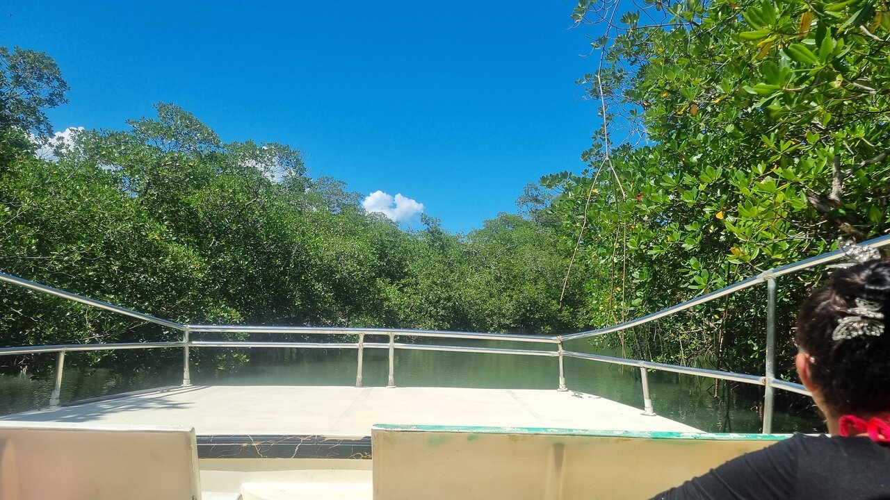
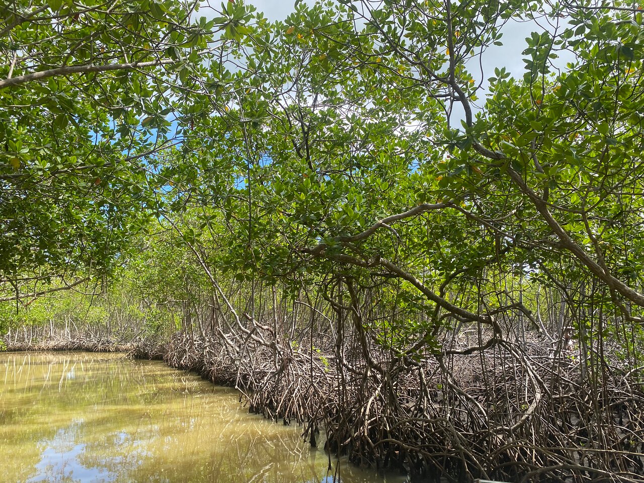
The uneven limestone terrain creates different conditions for soil, drainage, moisture and vegetation. Forests grow across the hills, while mangroves occupy sheltered coastal areas and waterways.
Rainwater may drain quickly through cracks and cavities in limestone, while other locations collect water in depressions or shallow basins. These differences influence where plants can grow and how habitats are distributed.
The park's mixture of karst hills, humid forest, mangroves and coastal environments supports a variety of wildlife.
Birds use the forested hills and coastal vegetation for shelter and feeding. Reptiles, amphibians, insects and other organisms occupy different parts of the ecosystem.
The landscape is therefore more than a geological attraction. Its rock formations help create the physical conditions that support the park's biodiversity.
8. What Can Visitors See During a Trip from Sabana de la Mar?
Sabana de la Mar is an important access area for exploring the eastern side of Los Haitises. Visitors planning a trip from this part of the Dominican Republic may encounter several features of the karst landscape.
Depending on the route, conditions and authorized visitor areas, a nature excursion may include:
- Limestone hills: Rounded or steep-sided formations rising above the surrounding vegetation.
- Coastal rock formations: Limestone outcrops and forested formations visible from the water.
- Cave entrances: Natural openings within limestone formations where access is permitted.
- Mangrove channels: Coastal waterways bordered by mangrove vegetation.
- Forest-covered terrain: Green hills and vegetation growing across the karst landscape.
A boat excursion can provide a useful perspective because visitors can observe the relationship between the hills, coastal formations and waterways.
The exact route and stops depend on the operator and the conditions at the time of the visit. Travelers should confirm which locations are accessible before booking.
9. What Is the Difference Between Mogotes, Caves and Sinkholes?
These features are connected, but they describe different parts of a karst landscape.
Mogotes are elevated limestone hills that remain after surrounding areas have been weathered and eroded.
Caves are underground or partly underground spaces formed as water dissolves and enlarges openings in limestone.
Sinkholes, often called dolines in geological terminology, are depressions in the ground surface associated with karst processes.
Together, these features create the characteristic landscape of Los Haitises. A single area may contain hills, depressions and underground cavities that developed through related geological processes.
10. Why Is the Limestone Landscape Important to Protect?
The karst terrain of Los Haitises is a valuable natural heritage feature. Its caves, hills, coastal formations and underground drainage systems are part of a landscape that developed over a very long period.
Damage to limestone formations can be difficult or impossible to reverse on a human timescale. Removing rock, damaging cave surfaces, leaving litter or disturbing natural habitats can affect both the geological environment and the wildlife that depends on it.
Visitors can help protect the park by following a few simple practices:
- Stay on authorized routes and follow guide instructions.
- Do not carve, paint or write on limestone surfaces.
- Never remove rocks, fossils or other natural materials.
- Avoid touching cave formations.
- Take all rubbish away from natural areas.
- Respect wildlife and avoid disturbing nesting or resting animals.
- Follow restrictions around closed or protected sites.
Responsible tourism helps preserve the landscape so that future visitors can appreciate its geological and ecological value.
11. Tips for Photographing the Mogotes and Limestone Formations
The mogotes and coastal limestone formations offer excellent opportunities for nature photography.
For wide landscape photographs, try to include both the formations and their surroundings. A photograph showing a limestone hill rising above a mangrove channel can communicate the relationship between the geological and coastal environments.
A few useful tips:
Use a wide composition: Include the water, vegetation and limestone formations to show the scale of the landscape.
Look for reflections: When water conditions are calm, reflections can add depth to photographs.
Capture different perspectives: A boat-level view may show the height of a formation, while a wider view can reveal how several hills fit together.
Respect access restrictions: Do not enter closed caves or climb unstable rock formations for a photograph.
Protect your equipment: Water, humidity and rain can affect cameras and phones. A waterproof bag is useful during boat excursions.
12. Frequently Asked Questions About the Geology of Los Haitises
What type of rock forms Los Haitises?
The characteristic karst terrain is mainly associated with limestone, including rocks of the Los Haitises Formation. Geological descriptions also identify marly limestone and marl in the wider region.
What does the word mogote mean?
A mogote is a distinctive hill or isolated elevated landform associated with karst terrain. In Los Haitises, mogotes are generally rounded or steep-sided limestone hills.
How were the caves of Los Haitises formed?
Many caves developed as slightly acidic rainwater gradually dissolved limestone along natural cracks and openings. Over long periods, these openings expanded into larger cavities and passages.
Is Los Haitises a volcanic landscape?
The characteristic hills and caves of Los Haitises are associated with limestone karst processes, not volcanic mountain building.
Why does Los Haitises have so many unusual rock formations?
The area contains extensive limestone deposits that were exposed to long periods of chemical weathering, dissolution and erosion. These processes produced mogotes, depressions, caves and coastal rock formations.
Can visitors see the mogotes from Sabana de la Mar?
Yes. The eastern side of Los Haitises can be explored from the Sabana de la Mar area, and boat excursions may provide views of limestone formations. Routes and accessible stops vary, so visitors should confirm details before travelling.
Are all caves in Los Haitises open to visitors?
No. Access depends on park rules, safety conditions and conservation restrictions. Visitors should follow current official guidance and use authorized routes.
What is the best way to understand the karst landscape?
A guided nature excursion can help visitors recognize the relationship between limestone hills, caves, mangroves and coastal formations. Reading about the geology before visiting can make the scenery even more interesting.
Discover the Geological Wonders of Los Haitises
The landscape of Los Haitises is the result of a remarkable natural process. Ancient marine deposits became limestone, geological changes exposed the rock, and rainfall gradually carved it into hills, depressions, caves and coastal formations.
From the green mogotes to the limestone islands around Samaná Bay, every part of the scenery tells a story about the changing landscape of eastern Hispaniola.
For travelers exploring the Dominican Republic, a visit from the Sabana de la Mar area offers an opportunity to appreciate this extraordinary environment. Plan responsibly, confirm current access conditions and choose an excursion that respects the national park's natural heritage.
Local explorer & expert guide in Birdwatching Guide.