The Rivers of Los Haitises National Park: Surface Water, Karst Drainage and Wetland Connections
Los Haitises National Park is often associated with limestone hills, mangrove forests, caves and small islands rising from coastal waters. However, rivers and streams are also important to understanding the park's natural environment. They move freshwater through the wider landscape, connect wetlands with larger drainage basins and help shape the relationship between the limestone terrain and the coast.
The river system around Los Haitises is unusual because the region is strongly influenced by karst geology. In a typical landscape, rainfall flows over the ground into visible streams and rivers. In karst terrain, some water enters cracks and underground openings instead. As a result, surface rivers, wetlands and groundwater can be closely connected.
The Río Yuna, Río Cevicos and Río Barracote are particularly relevant to understanding the wider hydrological setting of Los Haitises. Their connections help explain how water moves through the lower Yuna basin and the surrounding wetlands.
This guide explores the rivers associated with the Los Haitises landscape, how karst drainage works, why wetlands depend on connected water systems and what these waterways mean for conservation.
1. Understanding the River Geography of Los Haitises
Los Haitises should not be understood as a single river valley. It is a broad limestone and coastal landscape influenced by several drainage systems.
The national park and its surrounding hydrographic area are associated with the lower Río Yuna basin and the coastal region extending toward the northeastern Dominican Republic.
A geographic description of the protected area identifies the lower Yuna basin as one of the major hydrographic regions connected with Los Haitises. It also identifies rivers such as the Yuna, Barracote, Payabo, Los Cocos and Naranjo, together with smaller channels and coastal waterways.
The exact relationship between a river and the park boundary matters. Some waterways are associated with the wider hydrographic unit or surrounding landscape rather than flowing through the best-known visitor areas.
For that reason, this guide distinguishes between:
- Rivers that are hydrologically connected with the Los Haitises region.
- Watercourses that drain wetlands or karst areas.
- Larger rivers that receive water from the wider landscape.
- Coastal channels and mangrove waterways that visitors may encounter during authorized excursions.
Understanding these differences gives a more accurate picture of the region's water network.
2. The Río Yuna: A Major River Connected With the Los Haitises Region
The Río Yuna is one of the most important rivers in the Dominican Republic. It flows through the eastern Cibao region before reaching Samaná Bay.
The Dominican Ministry of Environment describes the Yuna as the country's most abundant river by flow and identifies its basin as a major drainage system. The river's watershed includes a large area of the country's northeastern and central-eastern landscape.
The Río Yuna is important to Los Haitises because the park's wider karst environment contributes water to the lower part of the Yuna basin.
A hydrographic study published by the Dominican National Geographic Institute explains that the Yuna receives the Río Payabo near the lower part of its course, before reaching Boca del Medio in Samaná Bay. The same study highlights the role of Los Haitises in supplying water to parts of the lower basin.
This connection is especially significant because the lower Yuna basin has fewer conventional surface tributaries than some other sections of the watershed. Water originating in the Los Haitises landscape helps support drainage in this downstream area.
The Río Yuna is therefore important not only as a major river in its own right but also as part of a larger hydrological network linked to the park's surrounding karst environment.
3. The Río Cevicos and Its Connection With Los Haitises
The Río Cevicos is particularly interesting because it provides an example of how water from the Los Haitises landscape can reach the lower Yuna basin.
The Dominican National Geographic Institute's publication Recursos Hidrográficos Superficiales de la República Dominicana explains that the wetland areas known as Ciénaga and El Junco receive water associated with Los Haitises and drain through the Río Cevicos.
The Río Cevicos then contributes water to the Río Yuna from its right bank.
This relationship demonstrates that the hydrological importance of Los Haitises extends beyond the water visible within the park's coastal scenery.
Why this connection matters
The Río Cevicos provides a link between:
- Wetland environments associated with Los Haitises.
- Surface-water drainage in the lower landscape.
- The larger Río Yuna watershed.
- The downstream coastal environment near Samaná Bay.
The relationship also shows why wetland conservation and river management should be considered together.
A change in water quality, drainage or land use in one part of a connected system may influence other parts of the watershed.
4. The Río Barracote: A Waterway Shaped by Wetlands and Low-Lying Terrain
The Río Barracote is another important watercourse in the wider Los Haitises–Yuna landscape.
The hydrographic study by José Luis Batista Silva describes the Barracote as a river or channel whose water supply is associated with Los Haitises. It flows through low-lying, marshy terrain where surface water and groundwater interact.
The study also describes a complex and changing drainage pattern, with smaller watercourses such as the Río Cristal and Caño Sandoval contributing to the local network.
This type of landscape is different from a steep mountain river. The terrain is low and wet, and water movement can be influenced by marshes, channels, groundwater and human modifications.
Why lowland rivers behave differently
In low-lying wetland environments:
- Water may spread across broad areas rather than remaining inside a narrow channel.
- Marshes can store water temporarily.
- Small channels may connect larger water bodies.
- Water levels may respond to rainfall and seasonal conditions.
- Surface drainage may interact with underground karst pathways.
The Barracote illustrates how a river system can be strongly influenced by the surrounding wetland landscape.
5. What Is Karst Drainage?
Karst drainage is the movement of water through landscapes formed in soluble rocks such as limestone.
Los Haitises has a strongly developed karst landscape. Rainwater can enter the ground through cracks, depressions and underground openings, reducing the amount of water that travels across the surface in visible streams.
This creates a drainage system that can be difficult to understand from a surface map alone.
Surface drainage
Some rainfall flows over the land into channels, streams and rivers. It may collect in depressions or move toward wetlands and coastal areas.
Underground drainage
Other water enters the limestone through fractures and openings. It travels through the underground system before emerging elsewhere.
Mixed drainage
In many karst landscapes, surface and underground drainage work together. A stream may receive groundwater, lose water into the limestone or change its flow depending on local geological conditions.
This is why the Los Haitises river system cannot be explained only by drawing lines between visible streams.
6. How Rivers and Wetlands Work Together
Wetlands are a defining part of the Los Haitises environment. They include marshes, waterlogged lowlands, coastal wetland areas and other habitats where water influences the soil and vegetation.
Rivers and wetlands are connected in several ways.
Rivers can supply water to wetlands
When water moves out of river channels or through smaller drainage routes, it may enter low-lying wetland areas.
Wetlands can store water
Wetland vegetation, soil and shallow water areas can temporarily retain water. This may slow the movement of water through the landscape.
Wetlands can release water into channels
Depending on local conditions, water stored in a wetland can drain into a river, stream or other outlet.
Groundwater can connect both environments
Research on Los Haitises has identified numerous wetlands within the karst environment that are linked to groundwater. This means that a wetland's water supply may not depend exclusively on visible rivers.
A 2013 scientific study of Los Haitises investigated rivers, springs and wells through water-level measurements and chemical and isotopic analyses. The research found evidence of relationships between groundwater and springs, illustrating the importance of looking at the whole hydrological system rather than treating each water body separately.
7. Why River Water Is Important for the Park's Wildlife
Waterways create habitats for many organisms and influence the distribution of wildlife throughout the wider landscape.
Rivers, wetlands, channels and mangrove environments support different ecological communities.
Fish and aquatic organisms
Freshwater and brackish waterways provide habitat for fish and other aquatic organisms. Species composition varies with water chemistry, salinity, depth and vegetation.
Wading birds
Shallow water and wetland margins can provide feeding areas for herons, egrets, ibises and other wading birds.
Invertebrates
Aquatic insects, crustaceans and other invertebrates are important parts of freshwater and wetland food webs.
Mangrove-associated wildlife
Coastal channels and estuarine environments connect with mangrove habitats, which provide nursery and shelter areas for fish and other marine organisms.
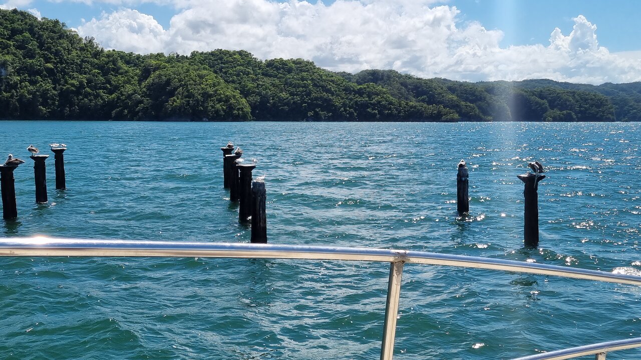
The official Dominican Republic tourism description of Los Haitises highlights the park's mangroves, coastal cays and birdlife, including pelicans, herons and egrets.
The presence of suitable water habitats helps explain why the park supports such a diverse range of wildlife.
8. How Rivers Connect With the Mangrove Environment
Mangroves grow in coastal areas influenced by tides and changing salinity. Their waterways are not simply freshwater rivers, even when they receive some freshwater from inland drainage.
The mangrove channels of Los Haitises are part of a coastal system in which several water sources interact.
These include:
- Seawater entering through tidal movement.
- Rainfall falling directly on the mangroves.
- Freshwater runoff from nearby land.
- Groundwater discharge where it occurs.
- Water moving through connected coastal channels.
The balance between freshwater and seawater influences the conditions in which mangrove trees and associated organisms can survive.
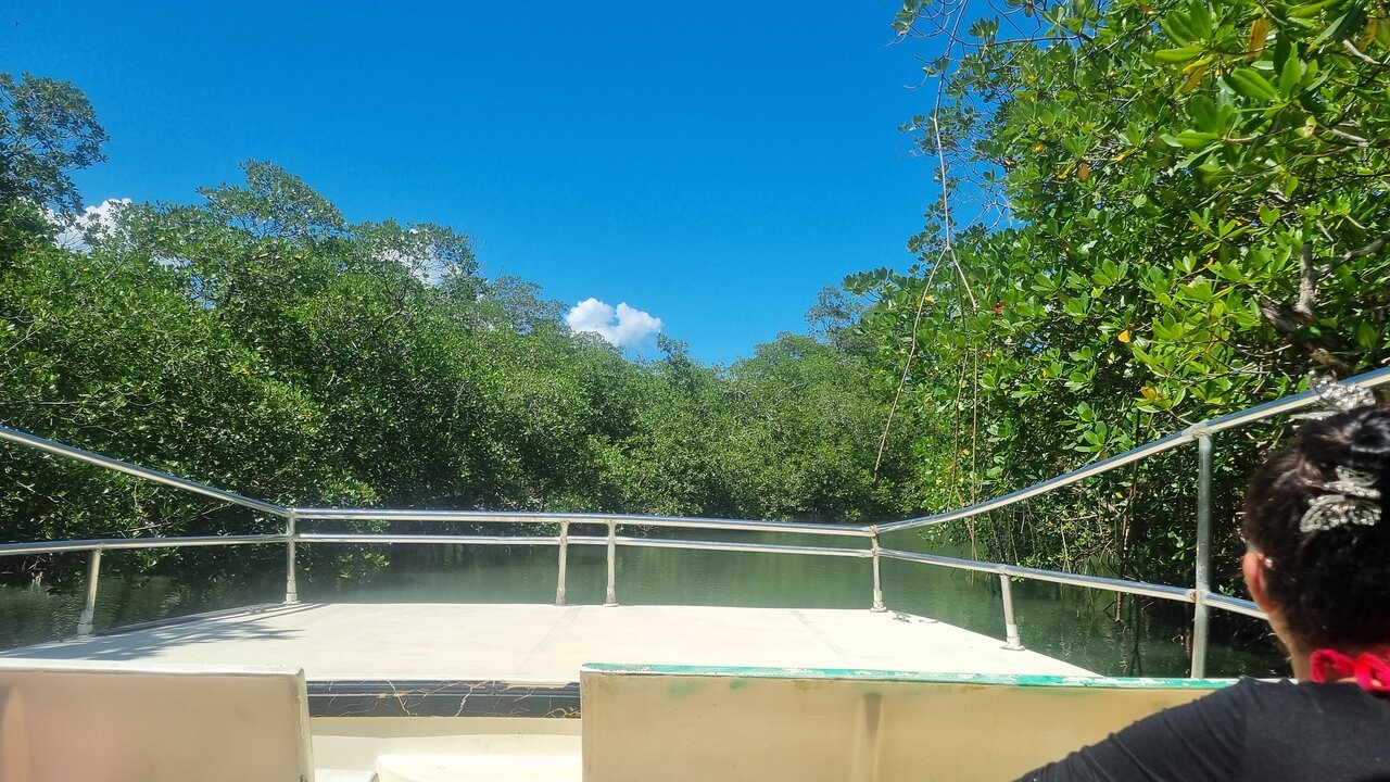
Visitors exploring the park by authorized boat or kayak excursions may see these channels as narrow waterways surrounded by mangrove vegetation.
However, the water in every channel should not be described as flowing directly from a named river. Individual channels can have different connections and tidal influences.
9. How River Systems Carry Sediment
Rivers transport more than water. They also carry sediment, including fine mud, silt, sand and organic material.
The amount and type of sediment depend on rainfall, soil conditions, vegetation, slope, erosion and river flow.
In the lower Río Yuna system, sediment transport is an important feature of the river's relationship with Samaná Bay.
The Dominican National Geographic Institute's hydrographic publication discusses the transport of suspended sediment by the Yuna and the accumulation of materials near its coastal outlet.
Why sediment matters
Sediment transport can:
- Build or modify riverbanks.
- Create sandbars and shallow areas.
- Add nutrients and organic matter to downstream environments.
- Influence the shape of river mouths.
- Affect the depth and condition of navigation channels.
Sediment is a natural part of river ecosystems. Problems can arise when excessive erosion or changes in land use increase sediment delivery beyond natural conditions.
10. How Seasonal Rainfall Changes River Conditions
River levels in the Dominican Republic are influenced by rainfall patterns.
The country's surface-water resources are not distributed evenly throughout the year. The national hydrographic publication identifies a broad contrast between the wetter period, generally May to October, and the less rainy period, generally November to April.
These are broad national patterns rather than a guarantee of conditions on a particular day in Los Haitises.
During wetter periods
- Rivers may carry greater volumes of water.
- Small channels can become more active.
- Wetlands may expand or hold more water.
- Heavy rainfall can increase erosion and sediment movement.
- Flooding may occur in low-lying areas.
During less rainy periods
- Some surface channels may carry less water.
- Wetland levels may change.
- Groundwater can remain an important contributor to certain water environments.
- Local water conditions may vary depending on the geology and rainfall history.
Because karst drainage can move water underground, visible river levels do not always show the full condition of the wider water system.
11. Why River Conservation Matters in Los Haitises
Rivers and wetlands are vulnerable to activities that change water quality, drainage patterns and vegetation cover.
Protecting the rivers connected with Los Haitises requires attention to the wider watershed, not only the places that visitors see.
Important conservation concerns include:
Water pollution
Wastewater, rubbish, fuel and agricultural chemicals can contaminate watercourses and connected wetlands.
Riverbank erosion
Removing vegetation along riverbanks can expose soil and increase erosion.
Excessive sediment
Land disturbance can increase the amount of sediment entering streams and downstream waterways.
Changes to natural drainage
Canals, embankments and other infrastructure can alter how water moves through low-lying landscapes.
Wetland degradation
Filling, draining or damaging wetlands can reduce their ability to store water and support wildlife.
Loss of vegetation
Natural vegetation helps stabilize soil, regulate runoff and maintain habitat around watercourses.
Protecting the river system means maintaining the natural relationships between water, soil, vegetation and wildlife.
12. Can Visitors Explore the Rivers of Los Haitises?
Los Haitises is known for boat excursions, mangrove channels, coastal scenery and kayaking experiences in authorized areas.
The official Dominican Republic tourism authority describes boat exploration and kayaking through the park's mangrove system as visitor activities.
However, not every river named in a regional hydrographic study is a public visitor route or an established excursion destination.
Before booking, ask the tour operator:
- Which waterways are included in the itinerary?
- Does the excursion travel through mangrove channels?
- Is kayaking included or offered separately?
- Are the routes currently authorized?
- What happens if weather or water conditions require a change?
A visitor does not need to travel along a major river to appreciate the hydrology of Los Haitises. Mangrove channels, coastal wetlands and the surrounding karst landscape offer opportunities to understand how water shapes the protected area.
13. Responsible Ways to Enjoy the Waterways
Rivers and wetlands are living habitats, not simply scenic routes.
Visitors can help protect them by following responsible practices.
- Never throw rubbish into the water.
- Avoid disturbing birds and other wildlife along riverbanks.
- Do not remove plants, shells, rocks or other natural materials.
- Follow the guide's instructions when travelling by boat or kayak.
- Avoid entering restricted waterways.
- Keep noise low around wildlife habitats.
- Do not release food, chemicals or other substances into the water.
- Respect temporary restrictions caused by weather, conservation work or safety concerns.
Small actions help reduce disturbance in fragile aquatic environments.
14. The Rivers of Los Haitises as Part of One Connected Ecosystem
The river systems associated with Los Haitises show why the park must be understood as a connected landscape.
The Río Yuna receives contributions from the wider region. The Río Cevicos connects wetland drainage with the lower Yuna basin. The Río Barracote flows through low-lying terrain where surface and underground water interact.
At the same time, the park's wetlands, mangroves and coastal channels provide important habitats for wildlife.
These systems are connected through rainfall, runoff, groundwater movement, river flow and coastal processes.
Understanding these relationships is important for conservation because a change in one part of the water network may influence other parts.
The rivers are therefore more than geographical features. They are part of the natural processes that sustain the Los Haitises environment.
Frequently Asked Questions
1. What are the main rivers connected with Los Haitises?
The wider Los Haitises hydrographic region is associated with the Río Yuna, Río Cevicos, Río Barracote and Río Payabo, among other waterways. Not all of these rivers flow through the park's main visitor areas.
2. Does the Río Yuna flow through Los Haitises National Park?
The Río Yuna is a major river connected with the wider Los Haitises hydrological region. Its main course flows through the lower Yuna basin toward Samaná Bay. The park's karst environment contributes water to parts of the lower basin.
3. How is the Río Cevicos connected to Los Haitises?
Hydrographic research describes wetland areas associated with Los Haitises draining through the Río Cevicos, which then contributes water to the Río Yuna.
4. What is the Río Barracote?
The Río Barracote is a watercourse in the wider lower Yuna and Los Haitises landscape. Research describes its water supply as associated with Los Haitises and its route through low-lying, marshy terrain.
5. Why is the river system unusual?
The region contains extensive limestone karst. Some rainfall flows across the surface, while other water enters underground openings. Surface drainage and groundwater can therefore be closely connected.
6. Are the rivers connected to the mangroves?
The wider coastal water system includes river drainage, rainfall, groundwater and tidal seawater. However, the exact connection varies between individual mangrove channels.
7. What wildlife can be found around rivers and wetlands?
Wetland and river habitats can support fish, aquatic invertebrates, herons, egrets, ibises and other birds. Wildlife sightings vary by location and season.
8. Do river levels change during the year?
Yes. Rainfall influences river flow and wetland water levels. Broadly, the Dominican Republic experiences wetter and less rainy periods, but local conditions vary.
9. Do rivers carry sediment into Samaná Bay?
Yes. The Río Yuna transports sediment toward its coastal outlet. Sediment can influence river mouths, shallow areas and coastal landforms.
10. Can tourists kayak on the rivers of Los Haitises?
Authorized kayaking experiences are available in parts of the park's mangrove system. This does not mean that all regional rivers are open for kayaking. Confirm the specific route with an authorized operator.
11. Are the rivers safe for swimming?
Do not assume that a river or wetland is safe for swimming. Conditions, water quality, currents, wildlife and access rules vary. Follow park and guide instructions.
12. Why should the rivers and wetlands be protected together?
They are part of a connected water system. Pollution, erosion or drainage changes in one area can affect downstream habitats and the wider ecosystem.
Final Thoughts
The rivers associated with Los Haitises National Park reveal an important part of the region's natural history. The Río Yuna, Río Cevicos and Río Barracote help explain how surface water moves through a landscape shaped by limestone, wetlands and coastal processes.
Their connections with groundwater and marsh environments make the region's hydrology especially interesting. Water does not always follow a visible river channel; it can move underground, emerge through wetlands and eventually join larger drainage systems.
Protecting these waterways means protecting the habitats and natural processes that make Los Haitises special.
To understand Los Haitises fully, look beyond its limestone hills and mangrove scenery: follow the water that connects the entire landscape.
Local explorer & expert guide in Birdwatching Guide.