Saona Island Marine Geomagnetism: Earth's Magnetic Field, Ocean Navigation and Seafloor Magnetic Surveys
The ocean contains more than water, waves and underwater landscapes. It also exists within Earth's magnetic field, an invisible force that influences compass direction and provides valuable information for geophysical research.
Scientists study this magnetic environment through a field known as geomagnetism. When magnetic measurements are collected over the ocean, researchers can investigate geological structures, identify magnetic materials and support certain types of underwater exploration.
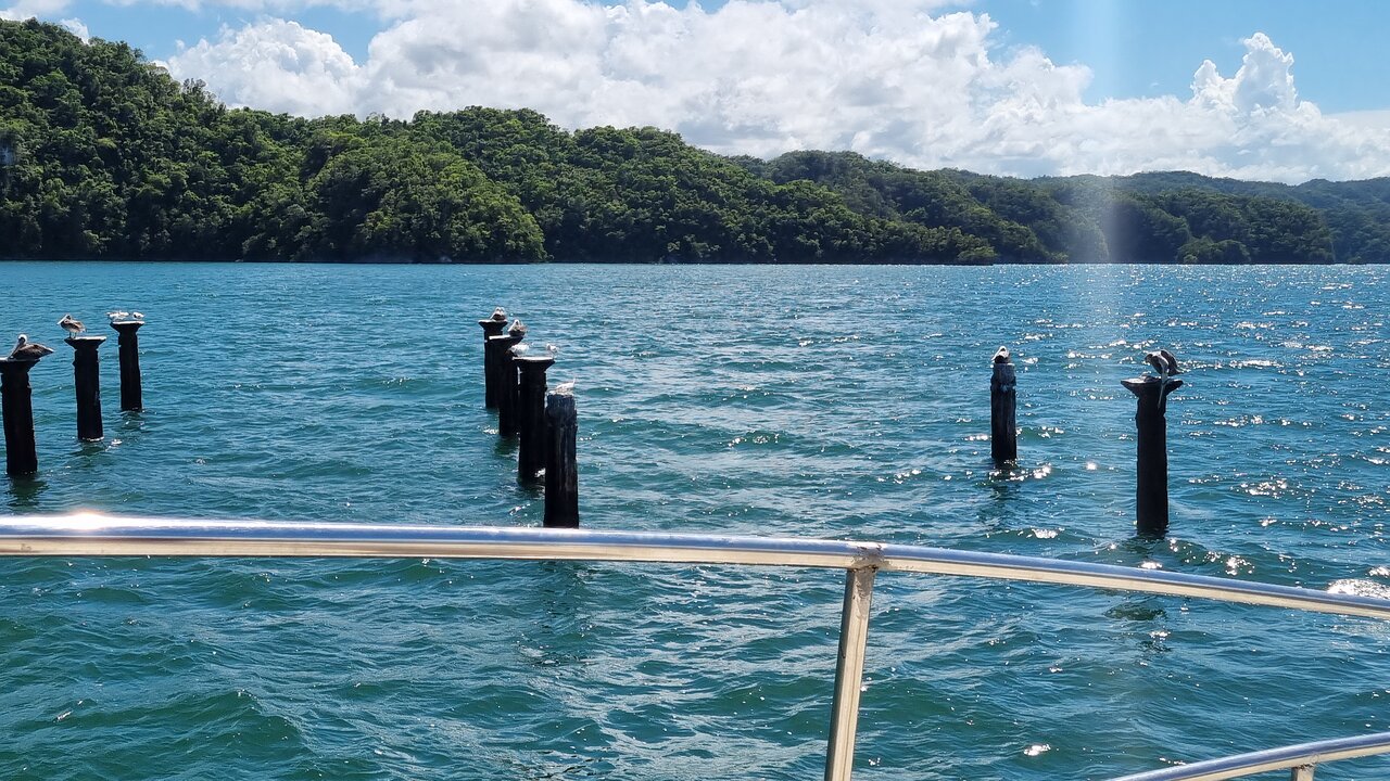
For an island environment such as Saona Island in the Dominican Republic, marine geomagnetism offers an interesting way to understand the relationship between Earth's magnetic field, coastal navigation and underwater geological research.
This article explains the science and technology behind marine magnetic surveys. It does not claim that specific magnetic anomalies, shipwrecks or survey results have been confirmed around Saona Island.
1. What Is Marine Geomagnetism?
Geomagnetism is the scientific study of Earth's magnetic field and its variations.
Earth behaves approximately like a giant magnetic system. Its magnetic field extends into space and influences how a freely moving compass needle aligns.
Marine geomagnetism applies magnetic measurements and geophysical methods to ocean environments.
Researchers can measure the magnetic field from research vessels, underwater platforms, aircraft and satellites. These observations help create a picture of magnetic-field strength and direction across different locations.
Marine geomagnetism has several important applications:
- Mapping geological structures beneath the seabed
- Identifying magnetic anomalies
- Investigating iron-rich geological materials
- Supporting marine archaeological surveys
- Detecting certain submerged metal objects
- Understanding regional magnetic-field variations
- Supporting magnetic navigation and geophysical research
The field combines geology, physics, oceanography, navigation and geophysical engineering.
2. Where Does Earth's Magnetic Field Come From?
Most of Earth's main magnetic field is generated deep inside the planet.
The outer core contains electrically conductive liquid iron-rich material. Movement within this fluid, influenced by Earth's rotation and internal heat processes, helps generate the magnetic field through a mechanism known as the geodynamo.
The resulting field extends beyond Earth's surface and interacts with the surrounding space environment.
The magnetic field is not perfectly stable. Its strength and direction change over time, and the magnetic poles move.
Scientists use measurements from magnetic observatories, satellites and other instruments to monitor these changes.
For marine research, understanding the background magnetic field is important because local geological materials and metal objects can produce additional magnetic signals.
3. Understanding the Main Magnetic Elements
Earth's magnetic field is a vector. This means it has both magnitude and direction.
Scientists describe the field using several magnetic elements.
Magnetic declination
Magnetic declination is the angle between geographic north and magnetic north.
A compass generally aligns with the horizontal component of the local magnetic field rather than pointing directly toward geographic north.
Declination varies with location and time. Navigators therefore need suitable magnetic corrections when converting compass directions into true bearings.
Magnetic inclination
Magnetic inclination, also called magnetic dip, describes the angle at which the magnetic field enters or leaves the horizontal plane.
It is measured relative to the horizontal surface.
Magnetic intensity
Magnetic intensity describes the strength of the magnetic field.
It can be expressed through total intensity and its horizontal and vertical components.
Magnetic-field intensity is commonly reported in nanoteslas (nT).
Together, these elements provide a more complete description of the geomagnetic field than compass direction alone.
4. What Is a Magnetic Anomaly?
A magnetic anomaly is a difference between an observed magnetic field and an expected background field.
Such variations may be caused by geological materials, iron-bearing minerals, metallic objects or other magnetic sources.
For example, rocks containing magnetite can influence local magnetic measurements because magnetite is strongly magnetic.
A submerged iron or steel object may also create a detectable magnetic response.
However, a magnetic anomaly does not automatically indicate a shipwreck or archaeological object. Geological structures and other sources can produce similar signals.
Scientists must examine the shape, strength, location and spatial pattern of the anomaly before deciding what it might represent.
5. What Is a Marine Magnetometer?
A magnetometer is an instrument that measures magnetic-field strength or changes in the magnetic field.
In marine surveys, a magnetometer may be installed on a research vessel, towed behind a boat or deployed using an underwater platform.
The instrument records magnetic observations along the survey route.
Positioning equipment, commonly using GNSS, records where the measurements were collected.
When the magnetic data are combined with geographic coordinates, researchers can create maps showing variations in magnetic intensity.
Common magnetometer types
Proton precession magnetometers
These instruments use the behavior of hydrogen nuclei in a magnetic field to measure total magnetic-field intensity.
Cesium vapor magnetometers
These sensors use atomic properties of cesium vapor to make highly sensitive measurements of magnetic-field intensity.
Fluxgate magnetometers
Fluxgate instruments measure magnetic-field components along one or more directions. They are useful in many scientific and geophysical applications.
Overhauser magnetometers
These instruments use a proton-based measurement method with additional techniques that can provide efficient and sensitive magnetic observations.
Instrument selection depends on survey objectives, required sensitivity, operating conditions and data-quality requirements.
6. How Does a Marine Magnetic Survey Work?
A marine magnetic survey measures magnetic-field variations over a defined water area.
A typical survey may follow these steps.
Step 1: Define the survey area
Researchers identify the area to be investigated and establish the survey objectives.
The project may focus on geological mapping, archaeological reconnaissance or the detection of magnetic materials.
Step 2: Select the magnetometer
The research team chooses an instrument that meets the required sensitivity and operational needs.
Step 3: Plan survey lines
The vessel follows planned tracks across the survey area.
Line spacing depends on the size of the target, survey objectives, expected anomaly dimensions and required resolution.
Step 4: Collect magnetic measurements
The magnetometer records the magnetic field while the vessel moves along the survey lines.
Step 5: Record geographic position
GNSS positioning links each magnetic measurement to a geographic location.
For towed instruments, the offset between the vessel's positioning antenna and the magnetometer must be considered.
Step 6: Apply corrections
The data may require corrections for regional background fields, temporal magnetic variations, sensor movement and vessel-generated magnetic interference.
Step 7: Process and interpret the results
Researchers examine the corrected data, identify unusual magnetic patterns and prepare magnetic-intensity maps.
Step 8: Verify potential targets
If a survey identifies an interesting anomaly, additional investigation may be needed.
Side-scan sonar, multibeam sonar, underwater photography, remotely operated vehicles or diver observations can help determine what produced the signal.
7. Why Is the Magnetometer Sometimes Towed Behind a Vessel?
A marine magnetometer is often towed behind the research vessel rather than installed directly beside the vessel's engines and metal structures.
This arrangement can reduce magnetic interference from the ship.
The towed instrument may be housed in a streamlined protective body commonly called a towfish.
A cable connects the towfish to the vessel and may provide communication or power, depending on the system.
The towfish is positioned at a suitable distance from the vessel to improve measurement quality.
Surveyors must account for the towfish's position relative to the GNSS antenna. Otherwise, the magnetic anomaly may be assigned to an incorrect geographic location.
8. What Geological Information Can Magnetic Surveys Reveal?
Different rocks contain different minerals and may have different magnetic properties.
Magnetic surveys can therefore help investigate variations in the geological structure beneath the seafloor.
Magnetic minerals
Magnetite is an important naturally occurring magnetic mineral.
Other iron-bearing minerals may also influence magnetic properties, although their responses vary.
Geological boundaries
Changes in magnetic properties can help identify boundaries between different geological units.
Buried geological structures
Magnetic surveys may reveal patterns associated with faults, intrusive rocks or other subsurface geological features.
Magnetic susceptibility
Magnetic susceptibility describes how readily a material becomes magnetized when exposed to an external magnetic field.
It helps explain why different rocks and materials produce different magnetic responses.
Magnetic measurements alone usually cannot identify a specific rock type with certainty. Geological sampling and additional geophysical methods may be necessary.
9. Marine Archaeology and Magnetic Detection
Marine magnetometry can support underwater archaeological investigations.
Iron and steel objects may create magnetic anomalies that help researchers locate possible submerged targets.
Potential survey targets include:
- Shipwreck remains containing ferrous materials
- Anchors
- Metal cargo
- Historical equipment
- Buried metallic objects
A magnetometer is especially useful when an object is hidden beneath sediment or is not easily visible in optical images.
However, magnetometry is not a complete archaeological identification method.
A magnetic response can indicate a target area, but researchers must use other techniques to confirm whether the source is archaeological, geological or human-made.
Archaeological interpretation should also consider historical records, site context and appropriate conservation procedures.
10. Magnetic Navigation Around Coastal and Island Environments
A magnetic compass provides direction by responding to the local horizontal component of Earth's magnetic field.
Marine navigators must understand the difference between magnetic north and true north.
Magnetic declination is particularly important when converting between compass bearings and geographic directions.
The correction varies with location and time, so a value taken from an old chart may not be suitable for every current navigation situation.
The World Magnetic Model and International Geomagnetic Reference Field are examples of mathematical models used to describe Earth's magnetic field.
NOAA's National Centers for Environmental Information provides geomagnetic calculators and reference products that can help estimate magnetic elements for specific positions and dates.
Magnetic navigation should be used with appropriate nautical charts, positioning equipment and current maritime guidance. It should not replace safe navigation practices.
11. What Can Interfere with Marine Magnetic Measurements?
Marine magnetic surveys can be affected by several sources of interference.
Vessel-generated magnetic fields
Steel structures, engines, electrical equipment and other components may influence measurements.
Nearby metallic objects
Anchors, cables, submerged debris and other metal objects can produce magnetic responses.
External magnetic variations
Solar activity and geomagnetic disturbances can change the magnetic field over time.
Sensor movement
Changes in instrument orientation and position can affect some measurements.
Incorrect positioning
A magnetic anomaly may be mapped incorrectly if the sensor's actual position is not calculated accurately.
Data-processing errors
Inadequate background correction, poor filtering or unsuitable interpolation can distort the final magnetic map.
Good survey design, instrument calibration, careful positioning and appropriate processing help reduce these problems.
12. How Could Marine Geomagnetic Research Be Designed for Saona Island?
A future study around Saona Island could investigate the regional magnetic field or explore specific geological questions.
A possible research design would include:
Research objective: Establish a baseline magnetic survey for a selected coastal area and investigate any significant magnetic variations.
Site selection: Define the survey boundary using suitable geographic information and existing marine data.
Background information: Review available geomagnetic models, geological information and previous survey records.
Instrument preparation: Calibrate the magnetometer and document its operating characteristics.
Survey planning: Design parallel survey lines with suitable spacing and positioning requirements.
Field measurements: Collect magnetic readings with geographic coordinates and relevant environmental information.
Data correction: Account for regional field variations, temporal changes, sensor position and possible vessel interference.
Mapping: Create a magnetic-intensity map and identify areas that require further investigation.
Independent verification: Use other geophysical or visual survey methods to investigate selected anomalies.
Scientific reporting: Document survey methods, instrument details, uncertainty, data coverage and limitations.
This is a proposed research framework, not a description of an existing Saona Island magnetic survey.
13. How Marine Geomagnetism Differs from Bathymetry
Marine geomagnetism and bathymetry are both useful marine mapping techniques, but they measure different physical properties.
Bathymetry measures water depth and seabed elevation.
Marine magnetometry measures variations in the magnetic field.
A bathymetric map can show the shape of underwater terrain, while a magnetic map can reveal variations associated with magnetic materials and geological structures.
The two methods can complement each other.
For example, a research project may combine bathymetry, magnetometry and sonar backscatter to obtain a broader understanding of the seafloor.
Combining independent datasets can improve interpretation, provided their geographic references, resolution and uncertainty are properly documented.
14. Future Developments in Marine Magnetic Mapping
Marine magnetic technology continues to improve through advances in sensor sensitivity, positioning, autonomous platforms and digital processing.
Potential developments include:
- Smaller and more sensitive magnetometers
- Autonomous underwater magnetic surveys
- Improved magnetic anomaly visualization
- Better integration with bathymetric datasets
- Automated identification of potential magnetic targets
- Long-term monitoring of regional magnetic variations
- Improved archaeological and geological survey planning
Artificial intelligence may help identify patterns in large magnetic datasets. Nevertheless, automated classification should be checked against geological knowledge and independent observations.
Frequently Asked Questions
What is marine geomagnetism?
Marine geomagnetism is the study and measurement of Earth's magnetic field and its variations in ocean environments.
What does a marine magnetometer measure?
A marine magnetometer measures magnetic-field strength or magnetic-field components. It can help identify unusual magnetic variations associated with geological materials or metallic objects.
What is a magnetic anomaly?
A magnetic anomaly is a difference between an observed magnetic field and an expected background field. It may be caused by rocks, minerals, metal objects or other magnetic sources.
Can a magnetometer find a shipwreck?
It can help detect magnetic signals from iron or steel components of a submerged shipwreck. Additional sonar, visual or archaeological investigation is normally needed to confirm the target.
Why does magnetic north differ from true north?
Magnetic north is based on Earth's local magnetic field, while true north refers to the geographic direction toward the North Pole. The angle between them is magnetic declination.
Does Earth's magnetic field change?
Yes. Its direction and strength vary with geographic location and time. Scientists monitor these changes through observatories, satellites and mathematical models.
Is marine geomagnetism the same as underwater electrical communication?
No. Marine geomagnetism examines magnetic fields and their variations. Electrical communication involves electrical signals generated or detected by marine organisms or equipment.
Are magnetic anomalies confirmed around Saona Island?
This article does not establish any specific local magnetic anomaly. Confirming one would require reliable magnetic survey data and appropriate geological or archaeological verification.
Conclusion
Marine geomagnetism provides an important scientific method for studying the invisible magnetic environment of the ocean. Through magnetometers, positioning systems and geophysical data processing, researchers can investigate magnetic anomalies, geological structures and certain submerged metallic objects.
For Saona Island, marine geomagnetism offers potential applications in coastal research, geological mapping, navigation and underwater exploration. However, accurate local conclusions depend on verified measurements and properly documented surveys.
By combining magnetic observations with bathymetry, sonar and geological information, scientists can develop a more complete understanding of the underwater environment.

Local explorer & expert guide in Birdwatching Guide.