Saona Island Marine Seismic Surveys: Mapping Hidden Geological Layers Beneath the Seafloor
Introduction
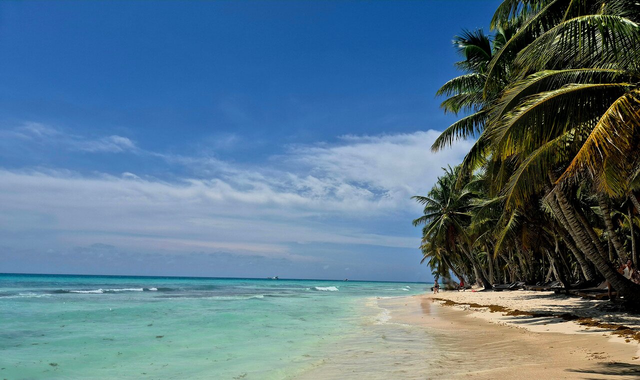
Saona Island is known for its beautiful Caribbean coastline, clear water and tropical landscapes. Yet the geological environment beneath the surrounding sea contains information that cannot be seen from the beach or a boat.
Marine seismic surveys are specialized geophysical investigations that help scientists explore the layers of sediment and rock beneath the seabed. By generating seismic energy and recording the signals reflected or refracted through underground materials, researchers can develop images of hidden geological structures.
These surveys are useful in marine geology, sediment research, offshore engineering, geological hazard assessment and scientific exploration.
For an island environment such as Saona, marine seismic methods provide a possible framework for investigating buried sediment layers, geological boundaries and the deeper structure of the seabed. This article explains the science and technology behind the methods without claiming that a particular seismic survey or geological discovery has already been completed around Saona Island.
1. What Are Marine Seismic Surveys?
Marine seismic surveys are geophysical investigations that use waves of energy to study geological structures beneath the seafloor.
A survey vessel moves along planned lines while specialized equipment generates or records seismic signals. These signals travel through the water and into the seabed. When they encounter boundaries between materials with different physical properties, some energy may be reflected back toward receivers.
Scientists record the returning signals and process them to create subsurface images.
These images can help identify:
- Sediment layers and their boundaries
- Buried geological structures
- Changes in sediment thickness
- Faults and fractures where resolution permits
- Possible buried channels
- Rock or sediment interfaces
- Geological features relevant to offshore development
The purpose is not simply to measure water depth. It is to investigate what lies beneath the seabed.
2. How Seismic Waves Travel Through the Earth
Seismic waves carry energy through geological materials.
Two important types of body waves are:
Primary waves (P-waves): These are compressional waves. Particles move approximately parallel to the direction in which the wave travels. P-waves can propagate through solids and fluids.
Secondary waves (S-waves): These are shear waves. Particle motion is perpendicular to the direction of propagation. S-waves travel through solids but do not propagate through fluids in the same way as ordinary elastic shear waves.
In marine seismic reflection surveys, compressional energy is commonly used to investigate the seabed and underlying geological layers.
The speed of seismic waves depends on the physical properties of the material through which they travel. Density, elasticity, porosity, fluid content and geological structure can all influence the measured response.
3. The Principle of Seismic Reflection
Seismic reflection is one of the main techniques used in marine subsurface imaging.
A seismic source produces energy that travels through the water and enters the seabed. When the wave encounters a boundary between two materials with different acoustic or seismic impedance, part of the energy may return toward the surface.
Acoustic impedance is commonly expressed as:
Z = ρ × V
Where:
- Z = acoustic impedance
- ρ = material density
- V = wave propagation velocity
A difference in acoustic impedance across a geological boundary can produce a reflection.
Receivers record the returning energy and its arrival time. By processing the recorded signals, geophysicists can identify reflection patterns and construct cross-sections of the subsurface.
The strength of a reflection depends on the contrast between the properties of the materials on either side of an interface, along with other factors such as wave frequency, incidence angle and attenuation.
4. Seismic Refraction and Its Importance
Seismic refraction is another geophysical technique used to investigate subsurface geological conditions.
When seismic energy reaches a boundary between materials with different wave velocities, the direction of propagation can change. Under suitable conditions, critically refracted energy travels along the interface and returns to receivers at the surface.
By studying travel times at different source-receiver distances, scientists can estimate seismic velocities and investigate subsurface layering.
Refraction methods can be useful for:
- Estimating depth to faster geological layers
- Investigating sediment thickness
- Characterizing near-surface geological materials
- Identifying major velocity contrasts
- Supporting geological and engineering investigations
Reflection and refraction are related but not identical. Reflection emphasizes energy returning from interfaces, while refraction examines changes in wave paths and travel times associated with velocity contrasts.
5. Marine Seismic Equipment
Marine seismic investigations use specialized equipment designed for operation from vessels or other marine platforms.
Seismic source
The source generates the energy used to investigate the subsurface.
Different systems are selected according to survey objectives and environmental requirements.
Examples include:
- Airgun arrays
- Sparker systems
- Boomer systems
- Chirp sub-bottom profilers
- Other specialized acoustic sources
Not all systems have the same energy, frequency range or penetration capability.
Hydrophones
Hydrophones detect pressure changes in the water and convert them into electrical signals that can be recorded.
They may be arranged in receiver cables called streamers, depending on the survey design.
Streamers
Streamers are cables containing multiple hydrophone groups. They are towed behind a survey vessel and collect seismic signals at different distances from the source.
Navigation and positioning systems
Accurate positioning is essential for connecting recorded signals to their actual locations. Satellite navigation, vessel positioning systems and survey sensors help determine where each measurement was collected.
Recording systems
Digital acquisition systems record seismic signals with accurate timing and location information. These records become the basis for later processing and interpretation.
6. Sub-Bottom Profiling: Imaging Shallow Geological Layers
Sub-bottom profiling is particularly useful for investigating relatively shallow layers beneath the seafloor.
A sub-bottom profiler sends low-frequency sound pulses toward the seabed. Some of the energy reflects from the seabed, while some penetrates into the sediment and returns from deeper boundaries.
The recorded signals can be displayed as a vertical profile showing the seabed and underlying reflectors.
Researchers may use these profiles to investigate:
- Sediment thickness
- Buried channels
- Shallow geological boundaries
- Sediment layering
- Possible hard or consolidated layers
- Shallow subsurface features relevant to marine research
The depth of penetration and resolution depend on the equipment, source frequency, signal strength and characteristics of the seabed material.
A sub-bottom profiler is not the same as every type of marine seismic system. It is commonly used for relatively shallow, high-resolution subsurface investigation.
7. Two-Dimensional and Three-Dimensional Seismic Surveys
Marine seismic surveys can be designed to produce different types of subsurface images.
2D seismic surveys
A two-dimensional survey collects data along individual survey lines.
The result is a vertical cross-section of geological structures beneath each line.
This approach can be useful for preliminary geological interpretation and broad regional investigation.
3D seismic surveys
A three-dimensional survey collects data over a more closely spaced grid of lines or using multiple receiver arrangements.
The resulting dataset can be processed into a three-dimensional representation of subsurface geology.
Three-dimensional imaging can help interpret complex structures that may not be fully understood from a single cross-section.
4D seismic surveys
Four-dimensional seismic surveys involve repeating comparable 3D surveys at different times.
By comparing the results, researchers can investigate changes in the subsurface.
This method is commonly associated with monitoring changes in producing reservoirs and other time-dependent geological systems.
The appropriate survey type depends on the scientific or engineering objective, the required resolution and the available resources.
8. Seismic Data Processing
Raw seismic data are not usually ready for direct geological interpretation.
The recorded signals may contain noise, unwanted reflections, multiples and other effects. Data processing helps improve the quality and usefulness of the seismic images.
Common processing steps include:
Data quality control: Checking recording quality, navigation, timing and equipment performance.
Noise attenuation: Reducing unwanted signals that interfere with geological reflections.
Filtering: Selecting useful frequency ranges and reducing some unwanted frequency components.
Velocity analysis: Estimating wave velocities to support travel-time interpretation and depth conversion.
Stacking: Combining suitable seismic traces to improve signal quality.
Migration: Correcting the apparent positions of reflectors and improving the spatial representation of dipping or complex structures.
Depth conversion: Converting seismic travel time into estimated geological depth using an appropriate velocity model.
The processing workflow depends on the acquisition system and the intended interpretation.
9. Understanding Seismic Travel Time
Seismic interpretation often begins with the time required for energy to travel from the source to a reflecting boundary and return to a receiver.
For a simple horizontal reflector and an approximate constant velocity, a simplified relationship is:
d = V × TWT / 2
Where:
- d = estimated depth to the reflector
- V = average seismic velocity through the material
- TWT = two-way travel time
The division by two accounts for the downward and upward travel paths.
This is a simplified relationship. Actual depth conversion may require detailed velocity analysis, corrections for changing geological layers and consideration of survey geometry.
10. What Geological Features Can Seismic Surveys Reveal?
Seismic surveys can help identify several types of subsurface geological features.
Sedimentary layers
Different sediment deposits may produce reflection patterns that help researchers understand the arrangement and thickness of geological layers.
Buried channels
Ancient channels may be preserved beneath younger sediments. Their geometry can provide information about past geological and environmental processes.
Faults
Faults may appear as disrupted or displaced reflectors where the data quality and survey resolution are sufficient.
Unconformities
An unconformity represents a geological boundary associated with a period of erosion or non-deposition. It may be visible as a surface separating different reflection patterns.
Buried geological structures
Some subsurface structures may be difficult to identify from the seafloor surface alone. Seismic imaging can help reveal their geometry and relationships with surrounding layers.
The interpretation of any feature requires careful assessment and, where possible, supporting geological or sampling evidence.
11. Marine Seismic Surveys and Coastal Engineering
Seismic information can support coastal and offshore engineering investigations.
For example, engineers may need to understand the geological structure beneath a proposed marine construction site.
Potential applications include:
- Preliminary investigation for offshore foundations
- Identifying buried geological boundaries
- Mapping sediment thickness
- Supporting pipeline route assessment
- Investigating potential buried channels
- Evaluating geological complexity before detailed site investigation
Seismic data do not directly provide every engineering property needed for foundation design. They should be combined with geotechnical investigations, such as boreholes, CPTu tests and laboratory testing, when engineering parameters are required.
This distinction is important: seismic surveys help image subsurface structures, while geotechnical tests measure or estimate the mechanical behavior of soil and rock.
12. Marine Seismic Surveys and Geological Hazard Assessment
Subsurface geological information can contribute to the assessment of some marine geological hazards.
Depending on the survey resolution and geological setting, seismic data may help investigate:
- Fault-related structures
- Buried channels and irregular sediment deposits
- Potentially unstable sediment layers
- Geological discontinuities
- Subsurface structures that may influence seabed stability
Seismic images alone do not prove that a geological hazard is active or that a particular site is unsafe.
Hazard assessment requires additional evidence, which may include geological mapping, geotechnical testing, historical information, earthquake records and numerical analysis.
13. Environmental Considerations of Marine Seismic Surveys
Marine seismic surveys introduce sound energy into the underwater environment. The potential effects depend on the source, operating conditions, location, duration and marine species present.
Some marine animals use sound for communication, navigation, feeding and detecting their surroundings. Underwater noise from human activities can therefore create concerns about disturbance, masking of biological sounds and, under some circumstances, physical effects.
Responsible survey planning should include environmental assessment and appropriate mitigation.
Possible measures include:
- Reviewing available marine habitat information
- Identifying sensitive species and important seasonal periods
- Selecting suitable survey equipment and operating parameters
- Establishing appropriate observation and monitoring procedures
- Using applicable exclusion or shutdown procedures
- Communicating with marine users and stakeholders
- Recording survey activities and environmental observations
Environmental management should be based on the actual proposed survey and the applicable laws and guidance of the relevant authorities. Requirements from other countries should not automatically be treated as Dominican Republic regulations.
14. How Marine Seismic Research Could Be Planned Around Saona Island
A possible marine seismic research project around Saona Island would begin with a defined scientific objective.
For example, researchers might want to investigate the thickness and arrangement of shallow sediment layers in a selected coastal area.
A responsible research workflow could include:
Stage 1 – Desktop research: Review available geological maps, bathymetric information, scientific publications and existing marine survey data.
Stage 2 – Survey planning: Select suitable survey lines, equipment, operating parameters and environmental safeguards.
Stage 3 – Field acquisition: Collect seismic or sub-bottom profile data using an appropriately equipped vessel.
Stage 4 – Positioning and quality control: Confirm navigation accuracy, recording quality and survey coverage.
Stage 5 – Data processing: Apply appropriate filtering, velocity analysis and imaging methods.
Stage 6 – Geological interpretation: Identify and interpret subsurface reflectors, sediment boundaries and possible geological structures.
Stage 7 – Ground verification: Compare the interpretation with suitable samples, boreholes or other independent geological evidence where feasible.
Stage 8 – Reporting: Present the survey methods, data limitations, interpretations and recommendations.
This is a proposed scientific framework, not a report of completed seismic research around Saona Island.
15. Limitations of Marine Seismic Surveys
Seismic imaging is powerful, but it has limitations.
Resolution limitations: Thin layers or small features may not be distinguishable if they are below the resolution of the survey.
Signal attenuation: Seismic energy decreases as it travels through geological materials.
Noise: Vessel activity, environmental conditions and other sources can reduce data quality.
Velocity uncertainty: Incorrect velocity assumptions can lead to errors in estimated geological depth.
Complex geology: Strongly dipping, fractured or irregular geological structures can be difficult to image and interpret.
Ambiguous interpretation: Similar seismic reflection patterns may be produced by different geological conditions.
For these reasons, seismic interpretation should be treated as a scientific model supported by evidence, not as a direct photograph of the underground.
16. The Future of Marine Seismic Research
Technology continues to improve the way scientists investigate underwater geological structures.
Developments in digital acquisition, navigation, signal processing, machine learning and visualization can help improve the interpretation of large seismic datasets.
Potential future directions include:
- Higher-resolution shallow seismic imaging
- More efficient survey acquisition
- Improved automated reflector interpretation
- Better integration with geotechnical data
- Three-dimensional geological modelling
- More effective environmental monitoring
- Improved methods for communicating uncertainty
For marine research around Saona Island, any future application should be based on a clear scientific purpose, appropriate permissions and careful consideration of the marine environment.
Frequently Asked Questions
1. What is a marine seismic survey?
A marine seismic survey uses seismic energy and underwater receivers to investigate geological structures beneath the seafloor.
2. What is the difference between seismic reflection and refraction?
Reflection studies energy returned from geological boundaries. Refraction studies changes in wave paths and travel times caused by differences in seismic velocity.
3. What is a sub-bottom profiler?
A sub-bottom profiler is a geophysical instrument that uses sound pulses to investigate shallow sediment layers beneath the seabed.
4. Can seismic surveys identify buried geological structures?
Yes. Depending on survey design and data quality, seismic imaging can help identify sedimentary layers, buried channels, faults and other subsurface structures.
5. Are marine seismic surveys the same as bathymetric surveys?
No. Bathymetric surveys measure water depth and seabed shape. Seismic surveys investigate geological structures beneath the seabed.
6. What equipment is used in marine seismic surveys?
Common equipment includes seismic sources, hydrophones, receiver streamers, navigation systems and digital recording equipment. Shallow investigations may use specialized sub-bottom profilers.
7. Can seismic surveys determine soil strength?
Not directly. Seismic measurements can provide information about wave velocities and subsurface structure, but engineering soil-strength parameters generally require geotechnical testing and appropriate interpretation.
8. Can marine seismic surveys affect marine animals?
Underwater sound from seismic operations may affect marine animals depending on the source, exposure and species. Environmental assessment and suitable mitigation are important.
9. Have seismic surveys mapped the geological layers around Saona Island?
This article does not establish that a particular marine seismic survey has been conducted around Saona Island. Verified survey records or published research would be needed to confirm that.
10. Why are seismic surveys important for marine research?
They help scientists investigate hidden geological structures, understand sedimentary history and provide subsurface information that can support geological research and offshore engineering.
Conclusion
Marine seismic surveys provide a way to investigate the hidden geological world beneath the seabed. Through reflection, refraction and sub-bottom profiling, scientists can develop images of sediment layers, geological boundaries and buried structures that cannot be observed from the ocean surface.
For Saona Island, these techniques offer a potential framework for future marine geological research. They may also support preliminary investigations for coastal and offshore engineering, provided that seismic interpretations are combined with suitable geological and geotechnical evidence.
Understanding the seabed is about more than knowing its depth. It also means understanding the geological layers beneath it and how those layers developed over time.
Local explorer & expert guide in Birdwatching Guide.